Free Australia Wide Bushfire Smoke Tracker

Moved to Forum: Original Link

FREE BUSHFIRE SMOKE TRACKER

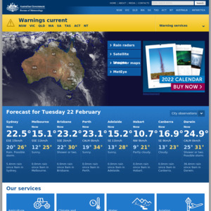
To see a free live satellite track of bushfire smoke anywhere in Australia - including Sydney - updated every ten minutes:

  1. Go to satview.bom.gov.au

  2. Click the layers symbol bottom left of screen.

  3. Select boundaries and cities.

  4. Zoom in on the area you want to see.

  5. Repeatedly push the left and/or right arrows at the bottom of the screen to see the source of each fire and it's smoke movement.

  6. The above can help people find places where they can go to find less or no smoke.

  7. This can be a massive relief for people with medical conditions.

  8. People, for example, in Sydney, could use this to take a train to areas with less smoke for some relief.

  9. Stay safe everyone.

Hope this helps.

Would rather no fires so there's no need for this.
Related Stores

bom.gov.au
bom.gov.au

Comments

  • +6

    Not a deal but appreciate the thought here for others.

    • +17

      Much cheaper than launching your own satellite :)

      • Not denying it's value in certain situations but it's still not a deal.

      • Thanks for the tip. Just saved me a tonne of coin. They told me I'll lose my deposit though :(

  • +1

    On the other hand, I'm already getting FREE bushfire smoke

  • -1

    no smoking bish fire

  • +2

    Not a deal, but a great example of tax dollars being well-spent.

    I’ll be using this on the weekend to go somewhere with less smoke, in the hope my burning eyes and lungs will get some relief.

    • +2

      The fossil fuel subsidies that caused the problem are much larger than the BOM's budget.

  • Nice. Thanks op

  • +2

    Also worth checking out earth.nullschool.net for various other views. This particular view is of carbon monoxide, but the other particulate filters can be interesting too. https://earth.nullschool.net/#current/chem/surface/level/ove…

    Obviously the sat view provided by BOM is more readily interpretable, but it's interesting to see the broader picture, and compare against other parts of the globe.

  • I just gotta open a window…… started getting worried on Monday but spoke to the cops who were across the road and said they'll drop in if we need to pack up and run. Not that there's anything left on the property to burn mind you.

  • I'm a very stupid man and all I see is a black map. Can somebody help a simpleton to use this map?

    • It shouldn’t be black, try a different browser.

  • +5

    I highly recommend using the Sentinal Hotspots Map produced by Geoscience Australia.

    While the RFS site shows the fire's "burnt area's", it does not tell you much about where the fires are actively burning, within the massive fire complex's (thousands of kilometres in area).

    Sentinal Hotspots can fill this gap and show you where "hotspots" (ie fires) have been actively burning in the past 48 hours.

    It is produced using data from thermal infra-red satellites orbiting Earth (More Info)

Login or Join to leave a comment