
Marketplace
Hi Guy
Another deal that i picked up for hiking and camping. There is also a more higher model Garmin 2.6-Inch eTrex 35 Touch for $119.7 (Was $399) if anyone is interested.
https://www.catch.com.au/product/garmin-2-6-inch-etrex-35-to…
Copy from catch-
This genius, compact, handheld device truly is what every outdoor man needs. Never again will you have to tirelessly fiddle with seemingly unfoldable maps, constantly getting lost or losing your GPS signal again! Thanks to the eTrex 10 you can easily navigate your way through bushy terrain, sun eclipsing canyons and more without ever losing your way. Its supremely lightweight design is further backed by an always readable 2.2" monochrome display, water resistant design and a lengthy 25 hour battery life on a single pair of batteries. If you're tired of passing the same tree, rock or road and wasting the day away trying to figure out where you are, then you really need this.
Features:
Garmin navigation accessories
eTrex 10 GPS
Colour: Yellow/Black
2.2" monochrome display
Worldwide basemap
Easy to read, view and track in any light
GPS and GLONASS satellites for faster positioning
Paperless geocaching
Download geocaches & details straight to your unit - display terrain, difficult, descriptions and more!
25-hour battery life
Water resistance: IPx7 - splashproof and up to 1 meter depth
Interface: USB
High-sensitivity reciever
Ability to add additional points of interest
Built-in hunting/fishing calendar information
Sun & moon charts
Withstands dust, dirt, humidity and water
Area calculation
Comes with Garmin Connect - online community to share data
1000 storable locations, 50 routes and 100 saved tracks
Internal memory: Yes
Battery: 2 x AA (not included)
Screen size: 3.6 x 4.3 (L x W)
Screen type: Transflective & monochrome
Screen resolution: 128 x 160 pixels
Weight: 141.7g
Dimensions (approx cm): 5.4 x 10.3 x 3.3 (L x H x Depth)
Country of origin: N/A
12-MONTH MANUFACTURER WARRANTY
Please note: Cosmetic imperfections on outer box
What’s included:
eTrex 10
USB cable
Manual
Why not use maps.me or similar on phone?
For different use cases….for example:
I have 10 of these and use them for vehicle tracking on mine sites when undertaking noise measurements.
So can I put one in my vehicle and find it with another?
Probably not….and that's not the purpose in my case.
@zoner: At first I read that as a circular log that amounts to a total of one second worth of data stored 👀
1-second interval frequency?
Other comment says onboard 4GB storage - this is a model without microSD slot
@UsernameChecksIn: Yep, interval.
Regarding SD card, I don't use them
The unit can Store 100 tracks, If I'm not mistaken, 1 track at 1sec interval is 4hours worth of data
Hey mate, can you tell me the max frequency of tracking it can do? I wonder also if it can be always on /tracking via USB. Cheers
You can set it, 1sec is the min, not sure about the max. It last as long as the batteries, not sure about the usb though. It saves to tacking files , which are different files then the waypoints.
Phones have shorter battery life and are more fragile.
Battery pack and a big phone case
Sure, you can use your $1000 phone out in the bush for 3 days, rather than this $50 GPS, which one will suck more to lose?
I wouldnt go bush walking without a phone
Asking for trouble
Imagine needing to use your phone in an emergency then realising the battery is just about flat because it was logging your hike the entire time.
@Mokr: As a person that has 4wd a lot of The High Country your asking for trouble relying on a mobile phone fullstop.
For starters Mine says it’s too hot out in the direct Sun and shuts down 😳
The unit that was posted by O.P is not a safety device either. It will tell you where you are and how to return.
A PLB will let authorities know in case of an emergency..
Cheers
Battery pack and a big phone case
Or just carry this tiny tough purpose-built device.
The battery life lasts longer than my phone battery and it's waterproof meaning if I'm hiking and it's raining I don't have to worry about getting it wet.
Don't often see this model under $100.
Just watched some reviews saying the eTrex 10 doesn't let you update maps. For anyone who has one, has this been something that you found lacking?
I think you are correct, get the eTrex35 for map loading it has 4GB storage and SD Slot.
This is from Garmin:
"Even though the eTrex 10 does have a worldwide basemap loaded, it cannot be loaded with any additional mapping. The eTrex 10 does not have any internal memory for adding mapping, and there is not a microSD card slot for expanded memory. The eTrex 10 is considered to be a non-mapping GPS unit, designed for simplicity. The eTrex 10 was primarily made to save waypoints and tracks, so that you can find places and locations that are important and to keep you from getting lost."
Depends on where you intend to use it. If you're using it for hikes, the terrain generally takes a very long time to change. :)
If you're just using it to breadcrumb your hike then it doesn't really matter.
The etrex10 will tell you where you are, on a base world map (which doesnt have much detail.)
if you plot a route, or use a gps, the etex10 will tell you where you are along the route. so not having a detailed map doesnt not matter. if you are using it to log your trek, no detail map is also ok.
Also Garmin Montana 610 is 70% off and can be grabbed for just $218, down from over $700.
https://m.catch.com.au/product/garmin-4-inch-montana-610-gps…
Might be worth noting it's a pretty old model. Still a good price for a brand new unit though.
Thanks for mentioning. I grabbed one for hiking/motorbike, these units are pretty good and for the price is the best I have seen. Not the newest unit but has all the connectivity needed and I love that it can use the lithium ion battery or AAs. Charge it fully and take it hiking, if the battery runs out throw some AAs in to keep it going.
Have you used these devices for motorcycling before? Any idea of this units benefits over OP's for this situation apart from the obvious screen?
OP seems enough for both unless I'm missing something? Another comment I read says slow to update terrain making it redundant for motorcycling I guess..
I've got a Montana 680T on my dirt bike and it works great.
Benefit vs etrex is full 1:25K topo maps, more waypoints and tracks, sd card for larger and custom maps and turn by turn navigation.
Great deal. Thanks for sharing.
I assume these are redundant if I have a Fenix 6X Saphire?
Bigger screen and heaps more battery life on this.
2.2" vs 2" l, fixed vs updatable maps, plus the convenience of an all-in-one device that's strapped to your wrist and keeps your hand free, and I already get a full 2 weeks battery on the 6X (not using maps that much though).
And what did you pay for your Fenix 6X? Serious question.
@d123: $700 at JB for the Sapphire edition, during the 2020 Black Friday catalogue (paid with cards bought busing my credit card points). Interestingly, there was a lot of talk of an imminent release of Fenix 7 at the time…It's now been more than a year…I don't do any hiking though and have switched to my Samsung Galaxy Watch 4 Classic 46mm, for the smarter features, but also prefer its workout tracking. Can't bring myself to sell the Fenix though, as I really like the look and the battery.
True. I have a fenix x6 Sapphire and I'm quite happy with it actually. The battery has always lasted an entire day hike if I remembered to fully charge in the morning.
And I much prefer colour display even if it is much smaller.
oh wow these things still exist
I had one 10 years ago and I think they are kind of redundant now
for your needs, yes. There is still a large community that finds these devices useful
most definitely! I was immersed in this back then, this is a fantastic little device for what it is and what it does (and how long it lasts)
nothing changed in this area I guess.
Screen resolution, colour, mapping, receiver sensitivity, battery life, size and weight, memory, UI… all that has improved since the original eTrex.
Definitely, phones are not as rugged and battery doesn't last as long and I have a Garmin Forerunner watch for GPS which is great for simple navigation but kind of useless if you need to nut out if a problem comes up.
The main issue with this budget version is the fixed maps. Prob worth grabbing the Montana 610 for $218 if you want to be able update maps/use different regions.
Biosecurity QLD use these for or similar models for tracking fire ant nests and they're pretty rock solid and very durable with long battery life
Must be really big ants if you can mount this on their back 😆
These are perfect if you kayak in open water.
Will this help me prove flat-earth theory?
yes. the map displayed on the screen is flat. therefore proving that the earth is flat
Of course! Plot a course due 45 degrees, and when you get to the corner keep doing the same
Meet me in the Octagon.
Thanks OP. I've been meaning to pick something like this up. Can't pass up 38 bucks!
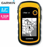
I was shocked by the '2.5hr battery' in the 1st picture :P
I was wondering about the same thing, by the time you really need it it's already flat. :D
Typo - it's actually 25Hrs.
Got one thx OP. I'm an entry level hiker and this is perfect for some casual activities out there in the wild. I don't need fancy color large touch screen for that. Mono color and AA batteries mean simple, reliable and long life span when it comes to electronic devices, just like the battery powered radio.
Exactly my reasoning for picking one up. Will make me a bit less worried about my phone going dead / no reception.
I should add a battery powered radio to my list!
The garmin Rino series is a GPS with radio
@BuyoTheCat thank you :) I will check them out!
I suppose this can be used as a GPS logger to geotag my photos?
It can. The way GPS logger works is:
Set the time on the logger and the camera to match.
The logger will log a point every set interval. A route will be plotted.
When you get to a computer, you will need to use a program/application to tag the route (usually as a .gpx) to the photos. it is tagged according to the timestamp on the .gpx and the image file.
!!!IMPORTANT!!!
The time set on the logger and the camera MUST be the same
Jeez the 35 Touch was a low price. Sold out. I've asked to be notified when they have more stock but it will probably be 3 times the price.
Hey guys does anyone knows if this also works as an emergency beacon?
Thanks!
It does not, it just lets you know where you are.
In a word: no.
Thanks, ordered one eTrex 35
Soold out?
Damn! Missed out.
Great Price