• expired

Nearmap Aerial View 1 Year Subscription $79.00

180

Good morning OzBargain,

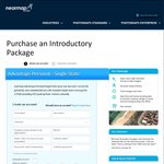
Just received an email from Nearmap stating that they are doing a trial personal use plan for 12 months access for $79.00

Although this may not seem like a bargain for the masses, I have been interested in using nearmap for a long time since it has become a 'paid-only' service and this is by far the cheapest I have heard it being.

The last I heard it was a ridiculous $980 for a years subscription for business with no personal access option.

With this in mind, although it is still expensive in my opinion, it does also represent a saving of over 90%

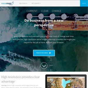
I work in construction and am considering subscribing to check out the progress as it happens, if you are getting a house built or are looking and properties this could end up saving you money in measuring up, ect.

From my experience the quality of nearmap is really good, and updated regularly.

There is however a downside to this as you will only have unlimited access for two months, after which it will revert to 50MB per month. (which according to their website is the equivilent to 4 sites per week.

Hope this can help someone out.

Cheers

In relation to this post
https://www.ozbargain.com.au/node/129286

Related Stores

nearmap.com
nearmap.com

closed Comments

  • I use this at work a few times a week, it's fantastic.
    Does this come with all the bells and whistles? Or just basic maps?

  • +3

    With this in mind, although it is still expensive in my opinion, it does also represent a saving of over 90%

    That supposition could be a bit flawed.
    Do you know if you will get exactly the same features as the business version, which costs $980/yr
    If the features are same, then you could say its a saving of 90%

    updated regularly

    How frequently is "regularly" ?

    • It's updated every few months in Sydney, and a few times a year in other areas that I used it for.

    • Yes, same features, also updated monthly in city areas.

  • +3

    Didn't this used to be free ?

    • +3

      It did used to be free until all the bugs etc were ironed out.

      The only free alternatives are:

      Google Maps which is pretty good but not updated very often
      https://maps.six.nsw.gov.au which is pretty good (better than Google for a lot of things) but not updated very often.

      • Also, here maps at www.here.com

        • The here-map from our area (south of Brisbane) is more than 650 days old

  • -5

    Should be free -_-

    • +3

      Then I wonder who is supposed to pay for the planes, fuel, pilots, insurance, etc etc?

      • +2

        Who pays for Google maps imagery and Google Street View cars, fuel, insurance, drivers etc etc?

  • Some parts of Sydney are updated monthly. I use it for work at 50MB per month ($65) and it is reasonable value for the amount that we use it (light use really, only a few sites per month). For $79/a it would be a bargain. This is for new subscribers only.

    From the Terms:
    Commercial Purpose means to distribute, transfer, sell, sub-licence or pass possession of any Products or Services (in whole or in part) for the purpose of direct commercial benefit or gain by You.

    So if you are just looking at the aerial photos and not selling them on to anyone else then I imagine that qualifies.

  • It was free while it was beta but they have to fly planes to take the photos and that ain't cheap. This is a more realistic price. I will be subscribing. Thanks OP

  • I use this at work too but it's only good for popular regions in Australia. Anywhere else, it just uses Google earth.

    50mb a whole month is really nothing though.

    • Only thing i see bad is this yeah, if they did 100mb a month, i think would be far better, and id be likely to subscribe.

  • +6

    Anyone in QLD should use the Queensland Globe plugin for Google Earth:-

    http://www.dnrm.qld.gov.au/mapping-data/queensland-globe/ins…

    Which uses generally uses the individual local authorities aerial maps for its imagery, so most of it is newer and of higher resolution than Google Maps. Other good things about it is Lot boundaries and Lot/Plan numbers, registered lot sizes, easements (although not what the easements are for), flood overlays and also flood imagery. We stopped using Nearmap at work once we found out about this (as Nearmap never updates our local area).

    • Didn't know about this (and I do GIS for a living) so thanks for that. We have to pay for all this data in the NT.

  • From my understanding it includes measuring tools and all the bells and whistles.

    • Even the new solar tool and rail?

      They are the two things I don't currently have access to.

  • Sounds good, they were updating Melbourne frequently before and the quality was better than google maps. I don't know of any alternative in Vic apart from google.

  • Usually updates at least once a month for Perth, but the last update was March…

  • +2

    Loved using it when it was free. Have been told that if you signed up previously that you could still login and view older/outdated maps??? I haven't been able too!

    • +1

      Nah snoop - that's game over. I'm in the same boat.

  • +2

    I was just about to sign up, but luckily I checked their coverage first… doesn't seem they've updated Tas since Jan 2012 :-/

    • +4

      Has Tasmania actually changed since 2012?

      • A few more cousins have married, but as far as overhead imagery is concerned, probably not.

      • Give em some credit… At least they're not New Zealand!!! ;)

  • I signed up and I notice that it automatically renews at the end of twelve months. I presume this will be at the same price?

  • WooHoo! Yeah! Great find. Thanks OP. Made my day!

    Have missed this since it went behind the wall. Have no problem with the pay to play, but why not put the prices up on the main page?

Login or Join to leave a comment